
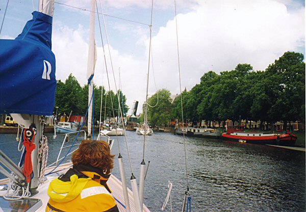
The Inland Route
If you dont fancy the North Sea trip, or up the Dutch Coast, there is a mast-up route through the Dutch inland waterways all the way from Vlissingen in the south to Delfzil in the North, emerging utilmately to the Ems on the German border.
This route will usually take boats with a draft of up to about 2 meters. Because of the number of bridges and locks involved, the route can take considerable time - usually about 2 weeks.
The whole experience is a holiday in itself.
Charts
You'll need a set of the ANWB Wateratlas canal charts. Numbers A, B,G,I and K cover much of the route, but you can now get the whole mast-up route in one chart. Its still best to suplement this with the Dutch Hydrographic Charts for the Lakes - 1803, 1805, 1807 and 1810, are all required.
You are supposed to carry a copy of the Dutch ANWB Almanac. Its a legal requirement to have Book 1 on Board, unfortunately, its in Dutch only, and all the useful information (Bridge Opening times, canal depths etc) are in Book 2
Zeeland
Zeeland is sometimes called the 'Dutch Riviera', and it is a holiday destination for many, both afloat and ashore. It is easy to get beguiled by the area and stay longer than you meant to, although the it gets very busy in season.
The route starts at the sea lock in Vlissingen. There is a small marina here, but a better bet for an overnight stay is to take the Kanal door Walcheren to Midddelburg, capital of the province of Zeeland. There are plenty of moorings and many shops.
North of Middelburg, there is one more lock to enter the Veerse Meer, near the ancient town of Veere. You leave the Veerse Mere by the Zandkreek lock. The route then traverses the Oosterschelde, the Krammer, the Volkerak and the Hollandsch Deep before arriving at Dordrecht.
Amsterdam
There are two ways to get to Amsterdam from Dordrecht, a distance of about 50 miles. The most direct route goes via the Nieuwe Meer, but has a section through the heart of Amsterdam which entails travelling in convoy, and at night.
The Hollandsche Ijssel gets you to Gouda, and the Gouwe to Alphen. Here you turn left onto the Oude Rijn for a short distance, until the canal branches. The Oude Rijn carries straight on towards Leiden, a route which, though longer, reaches Amsterdam without having to travel at night (see below). The route to the Nieuwe Meer branches right here.
There are two lakes (Braassemereer and Westeinderplas) to traverse before coming to the Nieuwe Meer, where there is a marina just short of the Railway Bridge at the north end.
The route between the Nieuwe Meer and the Nordzee Canal at Amsterdam is only 4 miles, but has 11 bridges, the first and tenth of which only open around midnight each day. There is a convoy system in operation in which all north-going boats traverse the section starting at around 11pm. Once all these boats are through, the south-going boats can start their trip. In practice this is either the highlight or the worst part of the trip, depending on your porint of view, as travelling in convoy in the dark in confined spaces is not some folks idea of fun.
An alternative to the overnight passage is to go via Leiden and take the Ringvaart to Haarlem and then the Spaarne and Zijkanaal C out to the Nordzee Canal, and hence to Amsterdam.
There are bridges on both these routes that have restricted opening times on Sundays and holidays, so careful planning is important. A good Dutch Waterways guide is essential.
The most popular marina in Amsterdam is the Sixhaven, just across the canal (via a free ferry) from the center of the city. As can be expected, the marina gets very full in season (in fact most of the time...).
The Ijsselmeer
From Amsterdam you take the remaining section of the Nordzee Canal out to the Ijsselmeer via the Orangjesluizen locks.
This inland sea is quite shallow in places, so attention to bouyage is advisable, and strong winds can whip up a sharp chop. Once again, the area is a destination in itself.
There is a barrier across the southern part of the Ijsselmeer (the Afsluitdijk), and you need to go through the locks by the very pretty town of Enkhuizen.
It is then a straight trot across the Ijsselmeer to Lemmer, which gives access to the Friesland lakes.
Freisland
The route from Lemmer finally out to the North Sea at Delfzil is long and winding for boats with their masts up. It travels in a roundabout route avioding low or unopening bridges through some remote countryside.
From Lemmer, you take the Prinses Margrietkanaal and the Van Harinxmakanaal to Leeuwarden. It is possible to exit the canals by travelling on to Harlingen, but for Delfzil, you turn right and take the Dokkumer Ee to Dokkum. The canal depths are supposed to be maintained in summer, but parts of this route tend to shallow and running aground is not unusual. The Dokkumer Grootdiep then takes you to Lauwersoog. There are a number of marinas here, and a lock out into the Waddenzee and hence the North Sea if you wish.
To carry on, you take the Reitdiep to Groningen. There are 11 opening bridges in Gronigen, and boats often travel in convoys, with the bridge master opening one bridge for yachts to go through, closing it behind them, then cycling to the next bridge to open it. This can lead to lots of fun and games when many yachts are squeezed into a small space in a hard blow. Like many other bridges, the bridge master also goes to lunch.
From Groningen, it is a fairly easy trip to Delfzil. There is a large marina in Delfzil just past the sea lock, and the town is just the other side of the wall.
From Delfzil, the trip up the Ems to Borkum is about 10 miles.